8 reviews for Cellular Tower Survey Reports
You must be logged in to post a review.

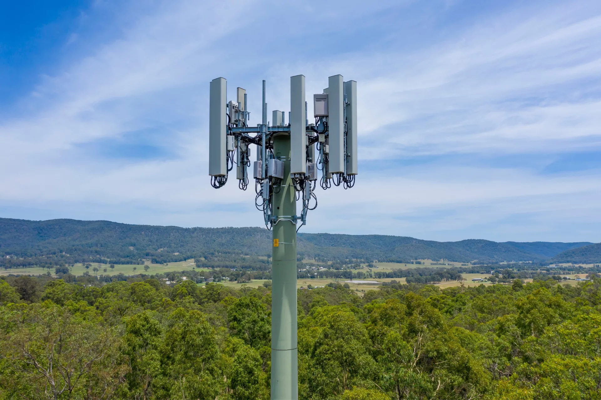
Our Cellular Tower Survey Reports help mitigate the hassles with determining what Cellular Carriers are available at a specific location, their headings, distance, elevation and other pertinent information.
The report can assist in:
The Reports are offered in two levels of service:
Disclaimer: Network carriers are constantly constructing and modifying towers to accommodate new services, frequencies and bands. All efforts are made to ensure the accuracy of our survey reports are based on the most current available data.
Survey Reports are prepared and delivered via email within two business days. Please direct all survey inquiries to: [email protected]
Our PDF format report contains general information on each tower to include:
The information is conveniently compiled on the first page of the report.
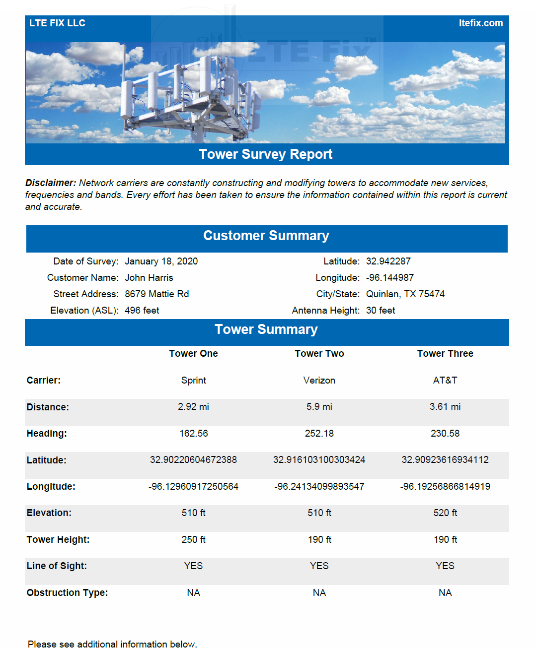
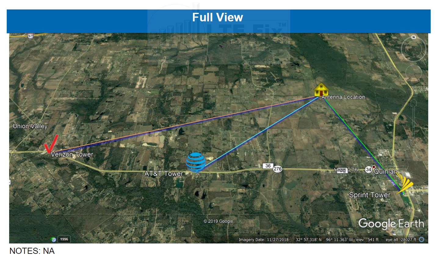
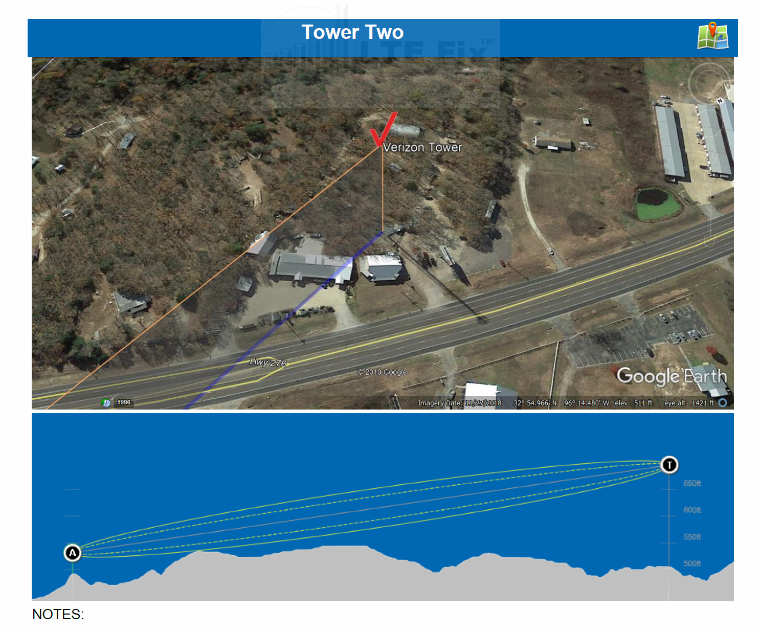
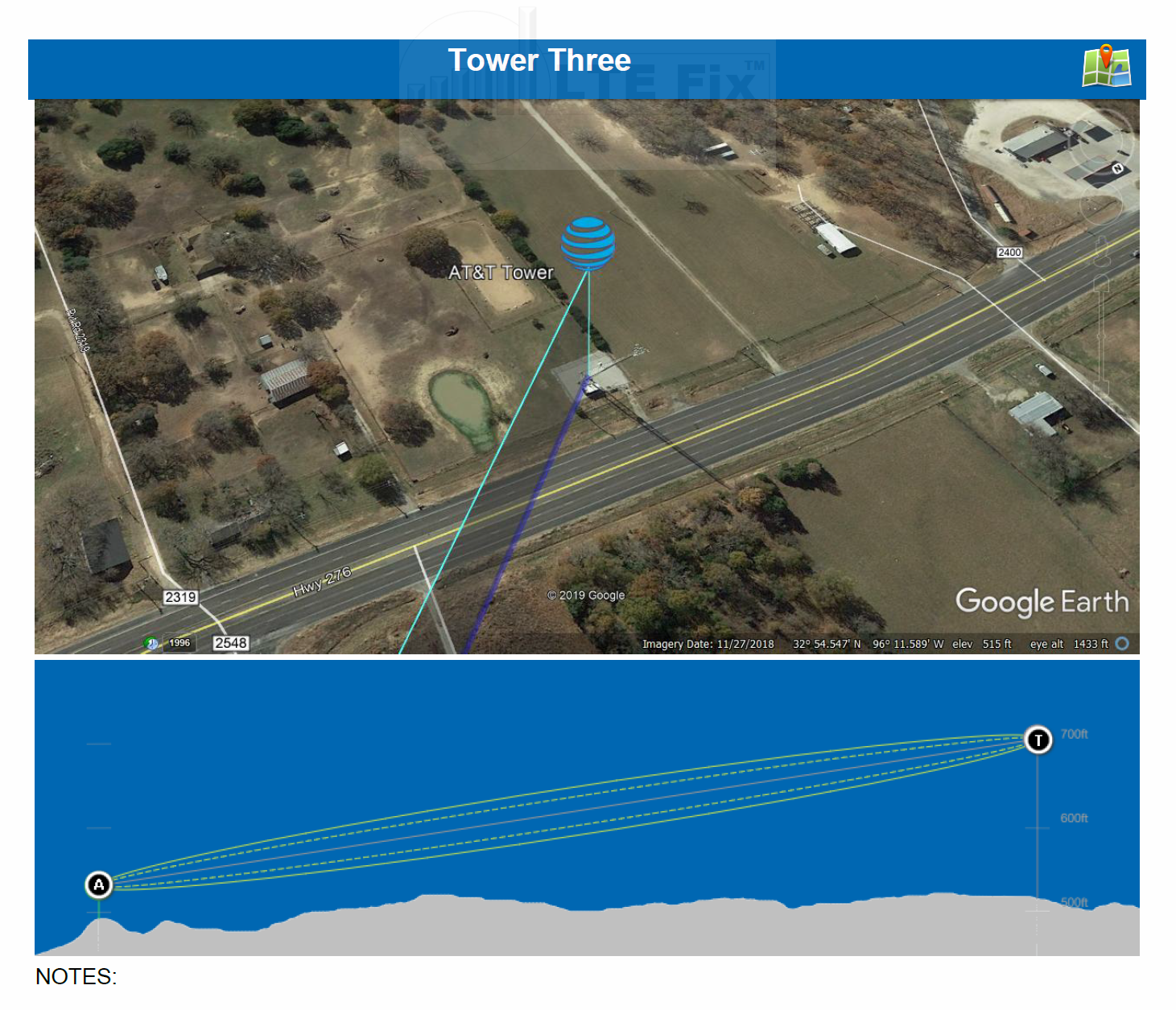
The report also include satellite images for a better visualization of the towers location in reference to a particular location.
The images included is this report are:
An example of these images based on the PDF three tower survey above are shown below:
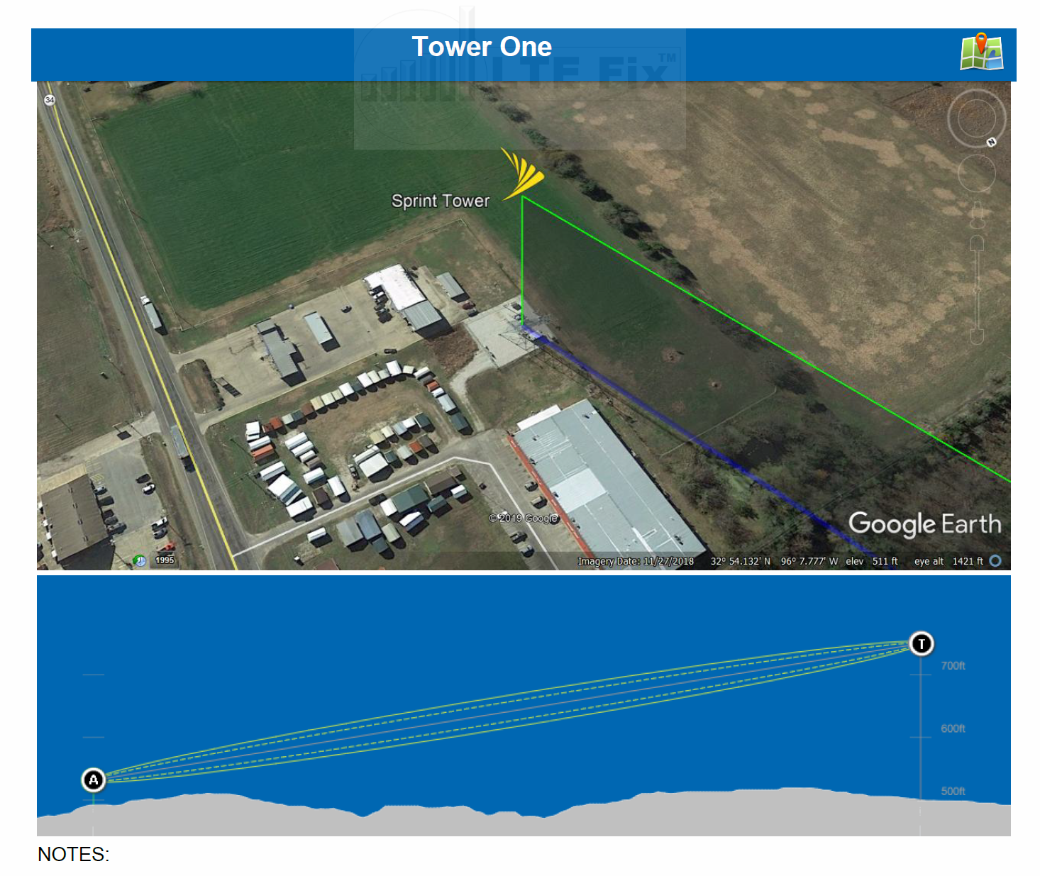

Clicking on the Mapping Icon on the top right of a Tower will open Google Maps and zoom into the tower’s location (Sprint, in this example).
This type of report includes the above PDF with satellite images along with a KMZ file for Google Earth. The quick video below will help to understand the value in this type of report.
When the Survey Report is prepared, the path between the customer’s location and cellular tower is visually examined by the preparer. The path is determined by the height of the customer’s antenna (as provided) and the height of the cellular tower.
The actual location that a carrier’s antenna is installed on a tower–in relation to the overall height of the tower—can impact a path’s elevation over obstacles. This may be further compounded when more than one carrier’s antenna is installed on a single tower.
When a report indicates an obstacle in the path, a brief explanation of the obstacle is provided. Knowing the type of obstacle will better assist in selecting an appropriate antenna system.
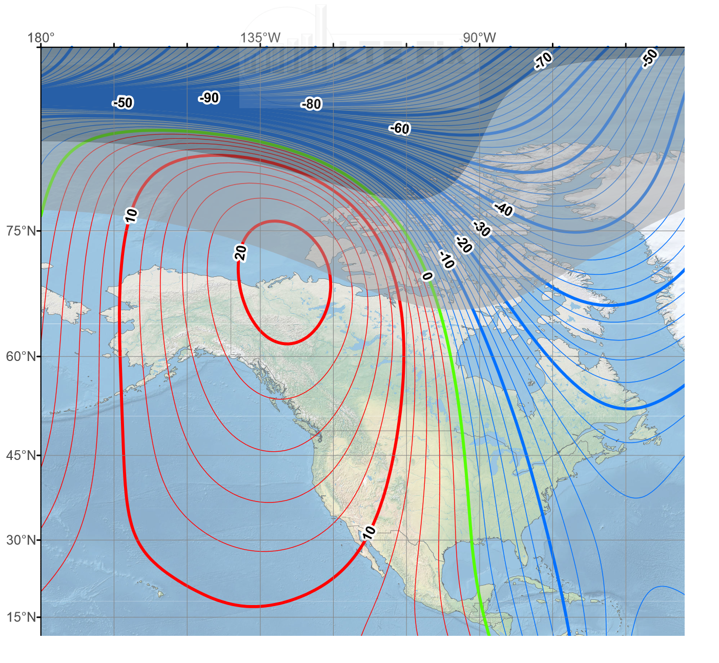
The majority of compasses do not point to the North Pole. They point in the direction of magnetic North, a spot in the Arctic that is near to (but not the same as) the North Pole.
A Survey Report is prepared using Magnetic North headings which may, in certain locations, require factoring in a magnetic variance. This will help assure its accuracy when the headings are used to aim directional antennas.
Read more and obtain your location HERE.
Learn more about True North HERE

MikeyrInJeff (verified owner) –
At last, some clarity on the location of nearest towers. The Cellmapper app/website is okay but is not exactly user friendly. The Cellular Tower Survey Report gives me granular information about each of the appropriate towers and whether or not they are terrain obstructed. Now, based on trees I can select the appropriate antenna and properly aim the antenna. This level of clarity is well worth the cost.
John Hunter (verified owner) –
I’ve been searching non stop for towers around me, apps and even well known websites were of little help. With the survey I received, it helped locate a tower I didn’t even know was close to me. Worth every cent for sure!
RG4Wireless08 (verified owner) –
Wish I did this earlier. Information worth every penny. Spent hours of research and didn’t come up with 5% of the useful information that was in this report. Received the full report within a day and the support team was wonderful to work with. Even through my many questions.
patrick hudson (verified owner) –
I’ve been looking into mobile hotspots, modems, etc. for better rural internet access and stumbled upon ltefix/hacks. I decided to give this a try to see how viable all the wireless providers (other than my current) in my area are for this and got exactly what I needed. The survey report gave me a ton of info such as the appropriate height needed for an outdoor antenna for the towers nearby. They even included an extra tower in the survey for free because they noted that one of these towers had multiple carriers. I’m definitely going to be getting hardware from these guys.
jeff gunter (verified owner) –
submitted my survey request late one night, and received the survey the next morning! the report was very helpful because it located the towers, some of which I knew, but others which I did not. it included required antenna heights, and a useful suggestion on how to repurpose my equipment to use a different (ie: better) tower. when I sent a followup email asking for clarification, I received a quite detailed lucid response the Same day. they included some links to useful information on the ltehacks website. can’t wait to follow their suggestions! I am very happy with the survey – I think it was well worth the price.
Leslie Banduch –
Great service and communication throughout the survey as they had to work hard to find towers in my rural remote location. Definitely worth the price!
EricHickerson –
I combed through numerous sites, apps, forums, programs and suggestions trying to locate the closest or at least a usable tower for a mobile internet setup. The resulting information was hard to use, incomplete, conflicting and dated. I am also surrounded by heavy woods and hills. Ordered a three tower survey of the closest towers and was overjoyed to discover a Verizon tower less than a mile from my cabin, and an AT&T tower two miles in the opposite direction. Initially thought this has to be a mistake as I have seen no reference to either of these towers. Opened the google earth survey file and WOW, there they were. In hindsight, ordering the survey would have spared me many hours of frustration and work. I highly recommend the KMZ google earth file to explore the terrain, elevation and obstacles on a micro level bases. Exceptional product and service.
Joseph Stackhouse –
Helped me discover a tower near my house that I didn’t know existed. Sure you can do your own research but you might miss something, this helped me.